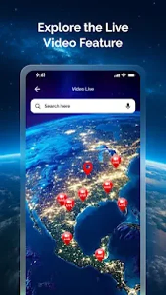
Explore the World with Go Earth Map
Go Earth Map: GPS Live Camera is an innovative application designed for travel and navigation enthusiasts. This free app allows users to explore real-time views of the Earth through live global camera feeds and HD satellite imagery. The interactive map gallery enables users to browse images from various locations, while GPS-tagged photos provide accurate location data. Features such as customizable photo editing with geotags enhance the user experience, making it easy to capture and share memorable moments.
With stunning 3D maps and precise GPS navigation, users can effortlessly navigate urban and rural environments. The app serves as a comprehensive travel companion, allowing for effective trip planning by previewing destinations before visiting. By merging live earth views with advanced mapping technology, Go Earth Map: GPS Live Camera offers a unique and immersive way to discover the planet from the comfort of your device.